MATIS

What is MATIS?
A corridor program aiming to deploy smart advanced ITS solutions within the frame of ITS directive and following MedTIS and atlantic arc programs.
For more sustainable, safer and resilient road transportation networks, contributing to the EU policy roadmap of vision zero fatalities and vision zero CO2 emissions (decarbonization of road transport within the grean deal and fit for 55).
Where?
From the mediterranean sea to the atlantic ocean:
- 4 members state: Italy, France, Spain and Portugal
- 18 000 km network (8 000 km of the TEN-T core network and 10 000 km of the comprehensive network)
- 8 cross border areas
- 10 metropolitan areas
- 15 major sea ports
- 89 ITS individual projects
- 3 TEN-T corridors: mediterranean, atlantic, north-sea mediterranean
What are the main objectives?
Making highways safer, smoother, reducing carbon emissions and achieving the objective of a more sustainable mobility.
Which solutions?
- Implementing C-ITS and new generation ITS projects
- Digitalizing the traffic management chain (data collection, data processing, on field traffic management)
- Developing big data processing
- Deploying artificial intelligence based solutions for better traffic monitoring
For:
- Implementing harmonized and coordinated ITS projects along 3 TEN-T corridors (mediterranean, atlantic, north-sea mediterranean)
- Ensuring a close coordination with the ITS Corridor projects of MERIDIAN and X4ITS in order to foster a common vision
- Contributing to cross-fertilization, best practices on ITS systems and services with the other ITS corridor projects, in compliance with EU legislation
- Addressing multimodal and modal shift
Which context and objectives?
In order to:
- Increase the level of service
- Reduce the number of accidents (a target of several hundred accidents reduction, on a five years period)
- Reduce the congestion volumes (a target of several hundred thousands lost hours reduction, on a five years period)
- therefore the CO2 emissions (a target of several thousand CO2 Tons emissions reduction, on a five years period)
- Facilitate the multimodality
With a high level of financial profitability Return On Investment (ROI) of about 5 years.
Find more informations:
The objective of MATIS is to deploy ITS for roads along the network covered by the project, addressing priority areas of the ITS directive.
The project includes the deployment of services to enhance the level of service in traffic Information and traffic Management, addressing the priority areas of the ITS directive, namely regarding real time traffic and travel Information, road safety related with traffic information and implementation of traffic management systems and plans. It will also implement infrastructure with the objective to support future C-ITS services and autonomous driving.
The ITS deployed will enhance road safety and multimodality, tackle road congestion and contribute to improve the environmental performance of the network.
The deployed ITS will also modernise the network, improve interoperability and continuity of service, further harmonise services and increase operational and cost efficiency of the network.
- TRAFFIC MANAGEMENT SERVICES AND TRAFFIC MANAGEMENT PLANS, INCLUDING CROSS-BORDER PLANS
- New equipment for data capture and traffic control
Deployment of cameras for traffic control and traffic management. They will have additional communication capabilities and higher performances compared to the old generation of cameras formerly deployed on the network, such as better resolution, better zooming, image stabilization and rain removal.
Many of these new cameras will allow using artificial intelligence and algorithm processing to automatically calculate individual and average travel times.
- New intelligent vehicle tracking systems, speed detection systems and traffic counting systems
Deployment of new vehicle tracking systems, speed control systems and traffic counting systems.
The new systems and related equipment deployed are based on radars, loops, smart cameras (for license plate reading), and sensors, that will take full advantage of artificial intelligence algorithms.
- New intelligent tools and software for assisting TMC operators in simulating, predicting travel time and monitoring traffic flows and level of service
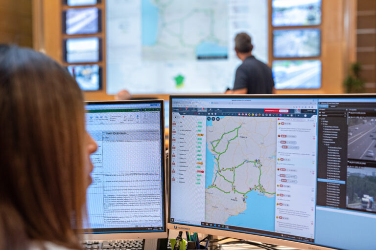
Deployment of new intelligent tools and software to support traffic management center (TMCs) operators in simulating, predicting travel time and monitoring traffic flows and level of service as well as ensuring faster and more accurate operational responses to traffic events.
This includes the development of new TMC software or the enhancement of already existing software by adding new functionalities.
- Field traffic management systems and equipment
Implementation of field traffic management systems on sensitive road sections subject to recurrent congestion. These systems aim to improve traffic by moderating the traffic flow.
- USER SERVICES AND INFORMATION
- Enhancing national data exchange and access points for data
Implementations needed for the further development of a National Access Point (NAP) dedicated to road information on the national road network, which covers the entire core and comprehensive public road network.
- Web portal and app for traffic and travel information
Upgrading application and website delivering real-time traffic information to users about the traffic conditions in a metropolitan area.
- New generation field equipment for traffic information
Deployment of new generation variable message signs (VMS) with new information services, such as travel time, accident information, alternative routes, dynamic lane management and multimodality information.
The new VMS deployed will include full color led graphic zone with better resolution and an amber led zone to show text as a matrix.
- ROAD SAFETY
- Advanced incident detection systems, including ghost vehicles detection
Implementation of advanced Automatic Incident Detection (AID) systems which enable to detect incidents on the roads. These systems are based on cameras and smart sensors using sophisticated algorithm processing and artificial intelligence, to automatically detect incidents.
- New hazardous goods tracking systems
Deployment of new hazardous goods tracking systems, enabling a better knowledge and control of the transit of hazardous materials vehicles, especially in sensitive spots, thus allowing the operator to analyze in real time the associated risks (such as spillage of pollutants on the roadway, emanation of toxic gases or explosion) and enhance the safety of users and for the infrastructure.
- New dynamic control systems for measuring weight of vehicles
Deployment of systems for identification of out-of-gauge weight vehicles, using intelligent video analysis systems and innovative sensors.
- New dynamic control systems for measuring height of vehicles
Deployment of systems for identification of out-of-gauge height vehicles ahead of tunnels accesses, in order to prevent vehicles from damaging equipment located in the tunnel vault with risks for other users
- ITS equipment to enhance tunnel safety
Deployment of new systems for increased safety in tunnels, in addition to the systems implemented under the previous tasks: dynamic lane management and speed management systems for traffic management in approach and inside tunnels, equipment and devices for monitoring and guidance for better evacuation in case of emergency, for safety inside tunnels, for higher IT network performance and resilience…
- Detection systems of weather conditions for increased safety
Deployment of new weather information systems in order to provide new weather data (weather stations and road sensors).
- Equipment for increased safety in a sensitive section
Implementation of a system designed to improve driving safety in precarious conditions, in the presence of fog, rain and other critical conditions to road safety. It includes the deployment of active LED signs installed in the traffic divider of the motorway.
- New generation SOS services
Deployment of systems to provide new generation SOS services, by means of new SOS equipment, software and applications.
- OPERATIONS AND SECURING SERVICE DELIVERY
- Systems for supervision, remote control and data acquisition
Implementation of Supervisory Control and Data Acquisition (SCADA) systems for monitoring and control of road network equipment.
- Cybersecurity for ITS systems protection
Implementation of innovative virtualization of ITS network communication, intrusion detection and prevention systems, as well as systems segmentation and cloud migration.
- High performance IT network for increased ITS resilience
Implementation of individual projects to perform improvements in the IT optical transmission network that are needed as result of the evolution of ITS systems and services deployed.
- New generation radio communication systems
Replacement of the current analogue-isofrequency radio communications (PS) networks by new digital mobile radio (DMR) communication systems and networks, for operation and emergency teams.
- C-ITS DEPLOYMENTS TOWARDS THE CONNECTED AND AUTOMATED MOBILITY
MATIS aims at developing C-ITS services and prepare autonomous vehicle driving through the implementation of smart roads and the development of an infrastructure for the dialogue between vehicles and infrastructure. New transmission network and new generation data collection systems using C-ITS technologies will be deployed. Some existing systems will also be gradually upgraded towards a connected and interoperable communication framework.